Apporo
Download PDF data sheet
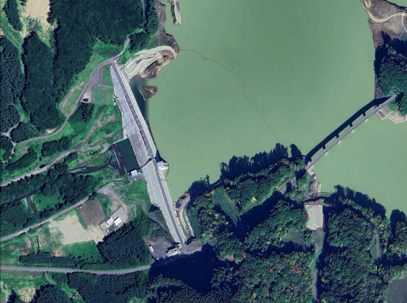
Apporo on Google Earth
Statistics
Type: Hardfill
Purpose(s): Flood Control / Irrigation / Water Supply
Reservoir capacity: 106 m3x106
Height: 47 metres
Length: 516 metres
Volume of RCC: 354 m3x103
Total volume: 490 m3x103
Construction Dates
Start of Project: 10/14 (October 2014)
Start of RCC: 06/15 (June 2015)
End of RCC: 06/16 (June 2016)
End of Project: 03/18 (March 2018)
Country: Japan
River: Atsuma
DMS Co-ordinates: 42˚46'0.28"N, 141˚59'35.36"E
DD Co-ordinates: 42.766743, 141.993149
Facings
Upstream
| Slope | Type |
|---|---|
| 0.80 | Traditional concrete against formwork |
Downstream
| Slope | Type |
|---|---|
| 0.80 | Traditional concrete against formwork |
Spillway
| Slope | Type |
|---|---|
| 0.80 | Traditional concrete against formwork |
Placement
| Layers (mm) | Lifts (mm) |
|---|---|
| 250 | 750 |
Cementitious material
| Cement (kg/m3) |
|---|
| 80 |
| Pozzolan (kg/m3) | Pozzolan Type |
|---|---|
| 0 | No pozzolan used |