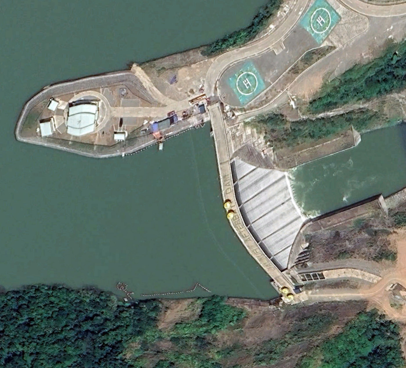
Jalaur afterbay dam
Download PDF data sheet
Jalaur afterbay dam on Google Earth
Particulars
Owner: National Irrigation Administration (NIA)
Designer: unknown
Contractor: Daewoo Engineering and Construction
Statistics
Type: Gravity
Purpose(s): Flood Control / Hydropower / Irrigation / Water Supply
Reservoir capacity: unknown
Height: 38 metres
Length: 150 metres
Volume of RCC: unknown
Total volume: unknown
Construction Dates
Start of Project: —/19 (— 2019)
Start of RCC: —/21 (— 2021)
End of RCC: —/23 (— 2023)
End of Project: 07/24 (July 2024)
Country: Philippines
River: Jalaur
DMS Co-ordinates: 11˚10'8.72"N, 122˚27'58.42"E
DD Co-ordinates: 11.169089, 122.466225
Facings
Upstream
| Slope | Type |
|---|---|
Downstream
| Slope | Type |
|---|---|
Spillway
| Slope | Type |
|---|---|
Placement
| Layers (mm) | Lifts (mm) |
|---|---|
Cementitious material
| Cement (kg/m3) |
|---|
| Pozzolan (kg/m3) | Pozzolan Type |
|---|---|