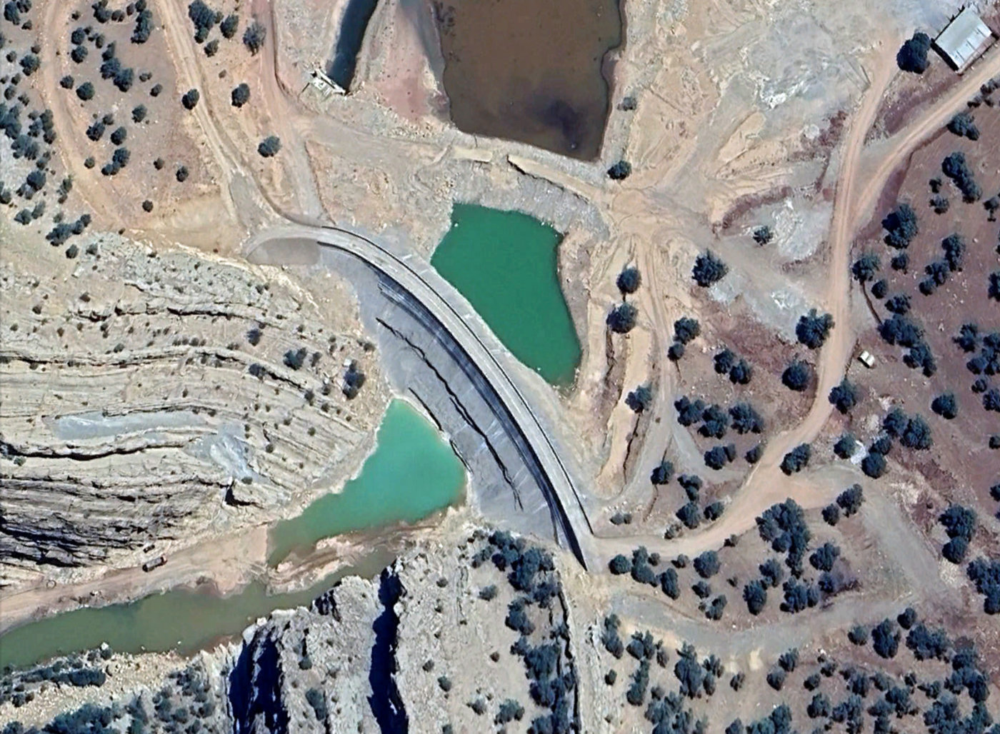
Tang e Mashooreh
Download PDF data sheet
Tang e Mashooreh on Google Earth
Statistics
Type: Thin Arch
Purpose(s): Flood Control / Irrigation / Water Supply
Reservoir capacity: 55 m3x106
Height: 73 metres
Length: 220 metres
Volume of RCC: unknown
Total volume: unknown
Construction Dates
Start of Project: —/13 (— 2013)
Start of RCC: —/22 (— 2022)
End of RCC: —/25 (— 2025)
End of Project: —/26 (— 2026)
Country: Iran
River: Karkheh
DMS Co-ordinates: 33˚48'35.07"N, 47˚50'24.00"E
DD Co-ordinates: 33.809742, 47.840279
Facings
Upstream
| Slope | Type |
|---|---|
Downstream
| Slope | Type |
|---|---|
Spillway
| Slope | Type |
|---|---|
Placement
| Layers (mm) | Lifts (mm) |
|---|---|
Cementitious material
| Cement (kg/m3) |
|---|
| Pozzolan (kg/m3) | Pozzolan Type |
|---|---|